-2")
Tracking a Couple of Light Snow Events Next Week
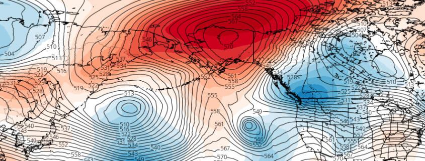
Winter is finally about to make a return to the Northeast, and given that we are nearing the peak climatology period for snow, this often comes with snow threats. Often times, though, in an initial pattern change, the pattern becomes cold and dry for a period. And while it’s certainly a possibility that we will be cold and dry for a while, there has been increasing evidence that we may be tracking 1, 2, or even 3 light snow events in the next week or so. It all starts with an amplified PNA ridge in the western half of the US that greatly interacts with a lot of disturbances in Canada. This forces these disturbances to interact with this ridge and slide down into the Central US and try to amplify in the Tennessee Valley and gain moisture in the process. This is how you can get a little clipper event to turn into something more substantial.
Initially, the flow is very compressed and elongated in the South and in the Atlantic. This will serve to prevent any phasing with STJ moisture and also try to send any low pressure that forms well out to sea. So the moisture development and getting a low pressure to pop close to the coast may be almost entirely dependent on the amplitude of the PNA ridge and the interaction of the shortwaves as they initially enter the US, which means moisture may be hard to come by.