-2")
Cold and clear start to December, watching this weekend’s storm potential
Good evening!
After a dreary and foggy weekend, we started the December work week off with much improved conditions across much of the Northeast. A weak cold front associated with an area of low pressure over eastern Canada moved through the Northeast and Mid Atlantic states early this morning, which effectively cleared out any lingering moisture from this weekend. Despite having the weak cold front move through this morning, the cold air behind the front was lagging behind just enough to allow for relatively mild conditions along the I-95 corridor. With mostly sunny skies and a above-normal mid level temperatures, we saw highs reaching into the lower to middle 50’s across much the region, with locations well north and west of the city seeing highs in the middle 40’s. These temperatures were above-normal for this time of year, but this may be the last day with above-normal temperatures for some time.
A weak and strung-out area of upper level energy is currently moving through the Northeast and Mid Atlantic this evening, which has brought an increase in clouds, with some rain and snow showers being reported over portions of western and northern NY state. While increasing clouds are likely for the remainder of this evening and into the overnight hours, any chance of precip will remain well to our northwest. The increasing clouds will likely quash any chance we have at getting decent radiational cooling during the overnight hours, so expect overnight lows to stay generally in the middle to lower 30’s for much of our area. Lows in the upper to middle 20’s will be possible for locations well to the north and west of the NYC area.
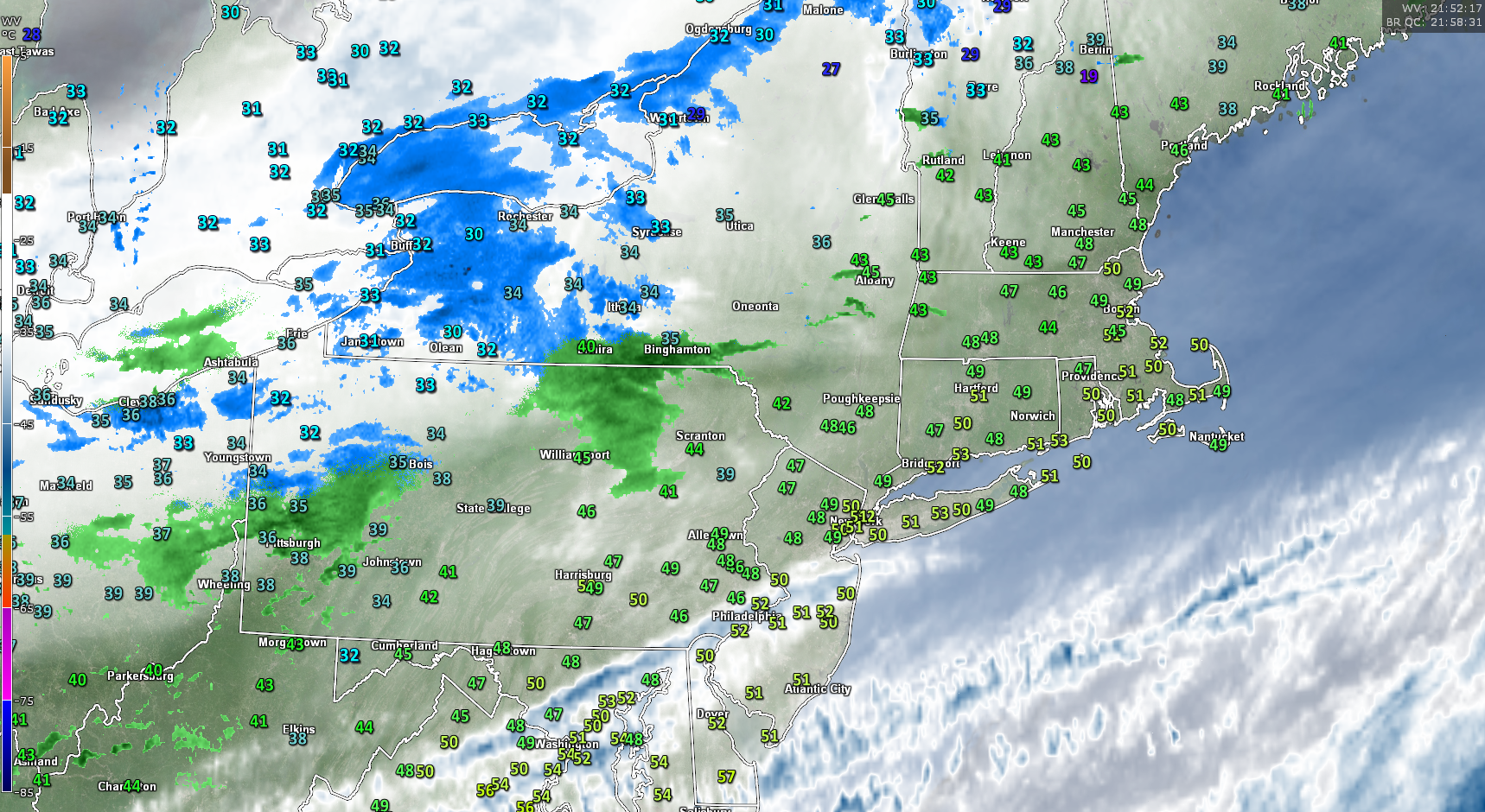
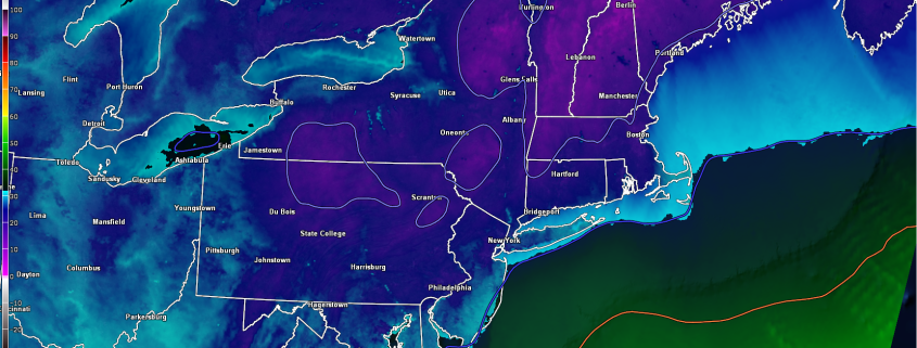
Radar, WV satellite, and surface temperatures as of 5pm over the Northeast.
Tuesday through Thursday
The weak area of mid to upper level energy moving over the area will likely begin to kick out of the Northeast by 8am tomorrow, which should pave the way for a clear, but cold start to Tuesday morning with temps likely in the lower 30’s for much of the New York metro area. With northwesterly flow in place, colder air will move down from Canada which will only allow for a rather limited increase in temperatures over the Northeast. Highs will likely only reach the middle 30’s during the afternoon hours Tuesday, which will be slightly below-normal for early December. Clear conditions will continue throughout the evening and overnight hours, with lows reaching down below freezing all the way to the coast for the entire Northeast. While the city itself and locations closer to the coast should get down into the upper 20’s, lower to middle 20’s will be likely for portions of northeast NJ and southern NY.
Wednesday should start off as yet another clear but cold day with highs staying in the middle to upper 30’s. Another elongated and disorganized upper level system will approach our area during the afternoon hours from the west, which may bring an increase in cloudiness, especially over portions of the Mid Atlantic and southern New Jersey. As this disorganized upper level system approaches the coast later in the day on Wednesday, it may have a chance to strengthen just a bit while its centered over the Delmarva peninsula. While most of the model guidance has any organization of this feature occurring well offshore Wednesday evening, there is a chance that this system is able to spawn an area of light snow showers over parts of the Mid-Atlantic and portions of southern New Jersey. While there is a relatively low chance of this happening, the mid to upper level setup shown on the reliable model guidance is one that has been known to cause whats is known as an “inverted trough”. These are incredibly difficult to predict even just a day or two out, but we will continue to monitor this potential in subsequent updates.
By Thursday, we should see another reinforcement of slightly below-normal temperatures as an incoming shortwave trough moves to our north over southern Canada. Available moisture looks to be very limited with this shortwave, so we’ll likely stay dry and clear for the vast majority of the day on Thursday. However as we head into the evening and overnight hours, we may see an increase in clouds and possibly some snow showers to the north and west of the city as upper level energy from the incoming trough begins to work its way in.
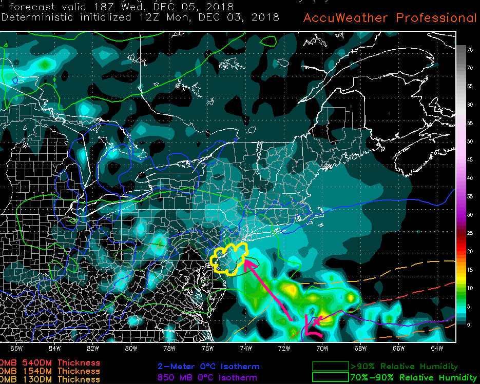
This afternoons ECMWF model showing increased moisture and lift near the NJ coast later in the afternoon on Wednesday.
Watching for a Potential Storm along The East Coast Later This Weekend
Once we get to Friday, our attention will begin to turn our West where an upper level low will be moving in over southern California. This system has been on our radar for quite a few days now as almost all of the reliable model guidance has shown this system becoming an impactful snowstorm for portions of the South and East later this weekend.
While model guidance has been highlighting the potential for a snowstorm over various points during the past couple of days, the delicate nature of the upcoming pattern has really allowed for significant run-to-run changes of where exactly along the South and East has the best chance of seeing significant snow. Despite this afternoons operational models and ensembles showing the bulk of this potential system impacting locations south of the I-95 corridor and into portions KY, NC, SC, VA, WV, we did see some changes from previous runs that may support this threat inching to the north to some degree over the next couple of days. The final outcome will ultimately rely on exactly where and when key pieces of energy will drop into the CONUS and (possibly) interact with the main energy over the South in addition to the positioning of a crucial low pressure system near Greenland (the “50/50 low”).
As of right now the overall threat for an impactful snowstorm for the NYC area is low. It is important to note that we’re also six days out and confidence is also very low at this time. The low confidence in this forecast is not only due to model inconsistency but also due to the fact that we have seen this kind of scenario many times in the past where a system is forecast to stay well to south around a week out, only to trend more organized and further north as we draw closer. We will be keeping a very close eye on this system during the remainder of this week so make sure to check back for updates!
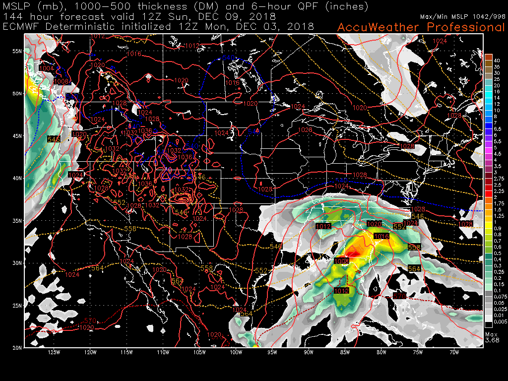
12z ECMWF showing the potential winter storm organizing over the Southeast on Sunday morning
Have a great night!
Steve Copertino