NYC Area Forecast: Cold today, rain chances return this weekend

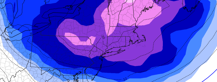
A deepening storm system in New England has done an effective job at tugging in some very cold air from Canada – and temperatures are well below normal throughout much of the Northeast states today. The movement of cold air, known more affectionately as cold air advection, will continue throughout the day today. Along with the cold temperatures will come blustery winds as the storm system deepens to our north and east.

Accordingly, the National Weather Service has issued Wind Advisories across parts of the Mid Atlantic, including Southern New Jersey. These Wind Advisories are placed where the strongest atmospheric pressure gradient is expected to be, where wind gusts will likely be the most impressive this afternoon. The Wind Advisories run until the very late afternoon, when stronger winds are expected to decrease in intensity.

Read more

NYC Area Forecast: Flash Flood Watch this afternoon and evening

Briefing: A Flash Flood Watch is in effect through tonight. Heavy rain is expected during the evening commute. A colder and active pattern will continue through early December.

Another round of moderate to heavy rainfall is expected this evening, on the heels of a heavy rainfall event that lead to localized flooding on Saturday evening. This system will approach from the Ohio Valley and Great Lakes today, with a secondary low pressure system forming off the New England coast. While not as intense as Saturday’s storm, it will again feature the potential for moderate to heavy rainfall.

With Flash Flood guidance already low from several weeks of above normal rainfall, the National Weather Service has issued a Flash Flood Watch for a large majority of Northern NJ, NYC, Southeast NY and Long Island for the potential for flash flooding, especially in flood prone/low lying areas. Rain is expected to begin during the early afternoon today, first over Eastern PA and Southern NJ, spreading gradually northward.

Read more

Confidence rising in a cold, snowier pattern through early December

For the better part of the last two weeks, forecasters in the Eastern United States have slept with one eye open, watching the upcoming weather pattern from late November through early December with a cautious, bated breath. Now, as Thanksgiving approaches, confidence is rising steadily in the ideas we have all been discussing: A colder than normal, and potentially snowier than normal, weather pattern is likely to unfold across the Eastern United States in the next four weeks.

Let’s back up for a moment: Happy Thanksgiving. Thanks for reading our article. Actually, thanks for reading our website at all. This has been one of the most successful years in our websites history, and we owe all of that to each of you who take the time to read what we write every day, or subscribe to our forecasts, or use our forecasts for your business. Thank you. Now lets get into the nitty gritty.

Read more

NYC Area Forecast: Record cold expected on Thanksgiving

The well-advertised cold ending to November appears likely to continue this week, and it may very well reach its most impressive point yet on Thanksgiving, when temperatures are expected to fall nearly 30 degrees below normal in parts of the Northeast states. A deep trough is expected to surge into New England, and north/northwesterly winds will usher in colder air from Northern Canada.

The National Weather Service is already forecasting record low maximum (and minimum) temperatures in many places throughout the Northeast on Thanksgiving, with low temperatures in the single digits and teens and high temperatures in the 20’s and lower 30’s.

Read more